Welcome to Larinda Survey

Larinda Survey merupakan salah satu pusat Penjualan GPS, Alat Survey, Alat Laboratorium, Telepon Satellite, Alat Komunikasi, DLL. Dengan Harga yang Terjangkau dan Bergaransi 1 Tahun. Kami juga merupakan Salah satu Dealer Garmin Terbaik Di Indonesia, dengan mengutamakan pelayanan yang semaksimal mungkin.

Jumat, 11 Desember 2015

Jual Garmin Monterra


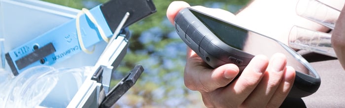
Detail Produk Garmin Monterra

GPS Mapping Powerhouse with Android™

  • 4″ dual orientation, sunlight-readable, durable mineral glass display with multi-touch interface
  • Get Android apps on Google Play™
  • 8 megapixel autofocus camera and 1080p HD video with automatic geotagging, LED flash/torch
  • High-sensitivity GPS/GLONASS receiver for better positioning
  • 3D MapMerge™ for multiple maps in 3-D
Monterra
Monterra is a full-featured Wi-Fi® enabled GPS navigator that combines our powerful mapping with the versatility of Android. Get Android apps for Monterra on Google Play, including PeakFinder, star constellation charts and ballistic calculator. Or access professional apps such as construction estimators and ArcGIS® to extend your office to the field. The rugged and durable Monterra has the power and flexibility to go anywhere.

3D MapMerge

Monterra is the ultimate mapping tool with custom 3-D mapping. Combine 2 maps, for example TOPO and BirdsEye Satellite Imagery, then view both maps in 3-D. You’ll see rich textures, such as hills, valleys, lakes and forests. Zoom in, pan out and rotate the 3-D map using multi-touch.

Quality Photos

Monterra includes a built-in 8 megapixel autofocus digital camera that takes vivid, geo-tagged photos for easy return navigation plus a 1080p HD video camera with LED flash/torch. You can download photos and video easily to your computer or for sharing through Garmin Adventures. Monterra has plenty of internal memory plus a microSD™ card slot for up to 64 additional GB of memory.

Powerful Battery, Beautiful Display

Monterra has a state-of-the-art dual battery system. You can use the rechargeable lithium-ion pack (included) or traditional AA batteries — the lithium-ion pack charges when device is connected to external power. Its 4″ color multi-touch display uses external light and sunlight in combination with the LED backlight to increase screen brightness. Plus, you conserve power by not having to turn on the backlight.

Get Your Bearings

Monterra has a built-in 3-axis electronic compass with accelerometer and gyro, which shows where you’re heading even when you’re standing still (or not holding it level). Once calibrated, its barometric altimeter tracks changes in pressure to pinpoint your precise altitude, and you even can use it to plot barometric pressure over time, which can help you keep an eye on changing weather conditions.
A built-in UV sensor lets you know your exposure level to sunlight so you can avoid sun damage, especially at higher elevations (5 percent increase in intensity every 1,000 ft of altitude) and on bright or reflective surfaces (snow, water, etc). And with its high-sensitivity, WAAS- and GLONASS-enabled GPS receiver, Monterra locates your position with more precision and maintains its GPS location even in heavy cover and deep canyons.

Share Wirelessly

With Wi-Fi, Bluetooth® and NFC, Monterra lets you share your data, maps, waypoints, tracks, routes and geocaches up to 50 times faster with other wireless compatible devices. Plus, you can share photos and data from field work through BaseCamp™ or by downloading directly to your computer.

Load Maps and Geocaches

Add BirdsEye Satellite Imagery (subscription required) and hit the trail. Add Trailhead Series TOPO maps and explore famous treks like the Appalachian Trail and the Pacific Crest Trail. Or, load up your GIS-based maps and go to work.
Monterra can hold thousands of geocaches. Download every cache on Geocaching.com. Load caches from GSAK. Or get your favorite Android app on Google Play. All your paperless geocaching features will be there for every cache. Read full descriptions, hints and logs. View cache photos. Filter caches by size, terrain, difficulty and type. Connect to chirp™ enabled caches.

Radio

Never miss vital information (or entertainment) with Monterra’s built-in FM radio and NOAA weather radio with SAME alerts. Get watches and warnings related to your location. Listen with headphones or share with the whole group through the built-in speaker.

Plan Your Next Trip

Take charge of your next adventure with BaseCamp, software that lets you view and organize maps, waypoints, routes and tracks. Create Garmin Adventures to share with friends, family or fellow explorers. BaseCamp displays topographic map data in 2-D or 3-D on your computer screen, including contour lines and elevation profiles. It also can transfer an unlimited amount of satellite images to your device when paired with a BirdsEye Satellite Imagery subscription.

Mount It Anywhere

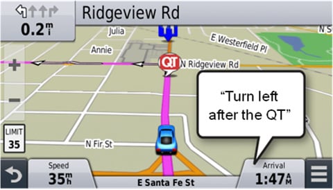
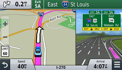
With an array of compatible mounts, Monterra is designed for use on ATVs, in boats, as a handheld or in your car. Use the automobile mount for spoken, turn-by-turn driving directions, or the rugged mount for your motorcycle or ATV.
Android and Google Play are trademarks of Google Inc.
WAAS enabled Geocaching ready Waterproof ANT

What’s In The Box :
  • Monterra
  • Lithium-ion battery pack
  • USB cable
  • AC adapter
  • Anti-glare screen protectors
  • Documentation

Physical & Performance

Physical dimensions2.9″ x 5.9″ x 1.4″ (7.48 x 14.96 x 3.63 cm)
Display size, WxH2″W x 3.5″H (5.06 x 8.93 cm); 4″ diag (10.2 cm)
Display resolution, WxH272 x 480 pixels
Display typebright, transflective 65k color TFT, dual-orientation touchscreen; sunlight readable
Touchscreen YES
Weight11.7 oz (331 g) with included lithium-ion battery pack; 13.2 oz (375 g) with 3 AA batteries (not included)
Batteryrechargeable lithium-ion (included) or 3 AA batteries (not included); NiMH or Lithium recommended
Battery lifeup to 16 hours (lithium-ion); up to 22 hours (AA batteries)
Water ratingIPX7
High-sensitivity receiver YES
InterfaceHigh-speed USB
Camerayes (8 megapixel with autofocus and 1080p/30fps video; LED flash; automatic geo-tagging)
Barometric altimeter YES
Electronic compassYes (tilt-compensated 3-axis)
Unit-to-unit transfer (shares data wirelessly with similar units) YES

Maps & Memory

Basemap YES
Preloaded mapsyes (topographic), some models
Ability to add maps YES
Built-in memory6 GB (With Worldwide Basemap); 3 GB (With TOPO U.S. 100K Maps)
Accepts data cardsmicroSD™ card (not included)
Custom POIs (ability to add additional points of interest) YES
Waypoints/favorites/locations4000
Routes200
Track log10,000 points, 200 saved tracks

Outdoor Features

Automatic routing (turn by turn routing on roads)Yes (with optional mapping for detailed roads)
Geocaching-friendlyYes (Paperless)
Custom maps compatible YES
Area calculation YES
Picture viewer YES

Garmin Connect™

Garmin Connect™ compatible (online community where you analyze, categorize and share data)

Additional

Additional
  • Bluetooth® wireless technology: yes
  • Wi-Fi connectivity: yes
  • ANT+® connectivity: yes
  • GNSS support: yes (GPS + GLONASS)
  • Near Field Communication (NFC): yes
  • Microphone: yes (internal for audio capture)
  • Multimedia (audio/video) support: yes (MP3 player, video player, etc.)
  • UV sensor: yes
  • Android with Google Play for complete customization

Kamis, 10 Desember 2015

Jual Garmin Etrex 30x


Detail Produk Garmin Etrex 30x

Handheld GPS, 3-axis Compass: Better Resolution and Memory

  • Greater resolution with 240 x 320 display pixels for improved readability
  • Internal memory expanded to hold more maps
  • Worldwide basemap with shaded relief
  • 2.2-inch, 65K color, sunlight-readable display
  • 3-axis compass and barometric altimeter
eTrex 30x is our upgraded version of the popular eTrex 30, with enhanced screen resolution for a more readable display and internal memory expanded to hold more maps. It retains the ease-of-use, durability and affordability that eTrex is legendary for and can also be used on ATVs, bicycles, boats, cars or hot air balloons.

See the Way

eTrex 30x has an enhanced 2.2-inch, 65K color, sunlight-readable display. Durable and waterproof, eTrex 30x is built to withstand the elements. It has an upgraded interface yet retains its legendary toughness to withstand dust, dirt, humidity or water.

New Tools for Your Trek

eTrex 30x adds a built-in 3-axis tilt-compensated electronic compass, which shows your heading even when you’re standing still, without holding it level. Also added is a barometric altimeter which tracks changes in pressure to pinpoint your precise altitude, and you even can use it to plot barometric pressure over time, which can help you keep an eye on changing weather conditions.

Go Anywhere

With an array of compatible mounts, eTrex 30x is designed as a handheld or for use on ATVs, bicycles, in boats, cars even hot air balloons. Use the auto mount capability and City Navigator NT®maps for turn-by-turn driving directions, or the rugged mount for your motorcycle or ATV. Wherever you think you might take eTrex, it has the mapping and mounts to get you there.

Go Global

The eTrex series is the first-ever consumer-grade receivers that can track both GPS and GLONASS satellites simultaneously. When using GLONASS satellites, a system developed by the Russian Federation, the time it takes for the receiver to “lock on” to a position is (on average) approximately 20 percent faster than using GPS. And when using both GPS and GLONASS, the receiver has the ability to lock on to 24 more satellites than using GPS alone.

Add Maps

With its microSD™ card slot and expanded 3.7 GB of internal memory, eTrex 30x lets you load TOPO 24K orGarmin HuntView™ maps and hit the trail, plug in BlueChart® g2 preloaded cards for a great day on the water or City Navigator NT map data for turn-by-turn routing on roads. eTrex 30x also supports BirdsEye Satellite Imagery (subscription required), that lets you download satellite images to your device and integrate them with your maps.

Share Wirelessly


Wirelessly connecting to a variety of compatible Garmin devices, including VIRB™ action cameras and ANT+® sensors (including heart rate monitor and bike cadence), the eTrex 30x can also read from and write to the chirp™ wireless beacon — or link with your trail buddy’s Oregon®, Montana®, GPSMAP® 64 or other ANT+-enabled outdoor navigation devices.

Keep Your Fix

With its high-sensitivity, WAAS-enabled GPS receiver and HotFix satellite prediction, eTrex locates your position quickly and precisely and maintains its GPS location even in heavy cover and deep canyons.

Find Fun

eTrex 30x supports geocaching GPX files for downloading geocaches and details straight to your unit. VisitGeocaching.com to start your geocaching adventure. By going paperless, you’re not only helping the environment but also improving efficiency. eTrex 30x stores and displays key information, including location, terrain, difficulty, hints and descriptions, which means no more manually entering coordinates and paper printouts. Simply upload the GPX file to your unit and start hunting for caches.

Plan Your Next Trip

Take charge of your next adventure with BaseCamp™, software that lets you view and organize maps, waypoints, routes, and tracks. This free trip-planning software even allows you to create Garmin Adventuresthat you can share with friends, family or fellow explorers. BaseCamp displays topographic map data in 2-D or 3-D on your computer screen, including contour lines and elevation profiles. It also can transfer an unlimited amount of satellite images to your device when paired with a BirdsEye Satellite Imagery subscription.

Physical & Performance

Physical dimensions2.1″ x 4.0″ x 1.3″ (5.4 x 10.3 x 3.3 cm)
Display size, WxH1.4″ x 1.7″ (3.5 x 4.4 cm); 2.2″ diag (5.6 cm)
Display resolution, WxH240 x 320 pixels
Display type2.2″ transflective, 65K color TFT
Weight5 oz (141.7 g) with batteries
Battery2 AA batteries (not included); NiMH or Lithium recommended
Battery life25 hours
Water ratingIPX7
High-sensitivity receiver
InterfaceUSB
Barometric altimeter
Electronic compass
Unit-to-unit transfer (shares data wirelessly with similar units)

Maps & Memory

Basemap
Ability to add maps
Built-in memory3.7GB
Accepts data cardsmicroSD™ card (not included)
Custom POIs (ability to add additional points of interest)
Waypoints/favorites/locations2000
Routes200
Track log10,000 points, 200 saved tracks

Outdoor Features

Automatic routing (turn by turn routing on roads)Yes (with optional mapping for detailed roads)
Geocaching-friendlyYes (Paperless)
Custom maps compatible
Sun and moon information
Tide tablesYes (with optional Bluechart)
Area calculation
Picture viewer
    Kelengkapan :

Jual Garmin Nuvi 57LM


Detail Produk Garmin Nuvi 57LM

Advanced Driving Navigation at a Value Price

  • Easy-to-use dedicated GPS navigator with 5.0-inch dual-orientation display
  • Preloaded with detailed maps of the lower 49 U.S. states with free lifetime¹ map updates
  • Garmin Real Directions™ guide like a friend using landmarks and traffic lights
  • Find new and popular restaurants, shops and more with Foursquare®
  • Direct Access simplifies navigating to select complex destinations, like malls and airports

Dedicated, Easy-to-use GPS Guidance

For driving directions on the road, put away the smartphone and power on your nüvi. nüvi 57LM is an easy-to-use, dedicated GPS navigator that does not rely on cellular signals and is unaffected by cellular dead zones. nüvi 57LM features sleek styling and a bright, 5.0-inch dual-orientation display, for use horizontally or vertically. Its included suction cup mount keeps it firmly in place.

Detailed Maps with Free Updates

nüvi 57LM arrives pre-loaded with detailed maps of the lower 49 U.S. states. With free lifetime¹ map updates, your routes are sure to reflect the most up-to-date maps, points of interest (POI) and navigation information available. New maps are available for download for the useful life of your GPS device, with no fees.

Garmin Real Directions

nüvi 57LM redefines “spoken turn-by-turn directions” with Garmin Real Directions, easy-to-understand driving directions that guide like a friend using recognizable landmarks, buildings and traffic lights. No more stress from trying to read street names. Instead, hear clearly spoken guidance, like “Turn left after the gas station.”

Foursquare Adds Millions of New POIs

nüvi 57LM makes it easy to find addresses and millions of POIs (points of interest) – that is, businesses, stores, restaurants or other destinations. Our POI database also includes accurate, relevant information sourced from Foursquare. Now, when you search, the most relevant Foursquare result appears at the top of the list. It’s an easy way to discover new and popular restaurants, shops and more.

Find Exactly Where You Need to Go

The Direct Access feature simplifies navigating to select complex destinations, like airports and shopping malls, by finding a place within a larger location. Direct Access even navigates through parking lots to find the entrance nearest your destination. When navigating to the mall, Direct Access gives additional location information for specific retail stores inside. For example, “Arriving at Woodfield Mall. Anthropologie is inside, on the upper level.”

Navigate Complex Interchanges with Ease

nüvi 57LM has lane assist with junction view that displays upcoming junctions and uses brightly colored arrows to indicate your proper lane.

Easier to Search, Quicker to Find

nüvi 57LM has a search field that makes it easy to find addresses and millions of POIs, in a single place. Now, simply enter a category (like “pizza”), an entire address (“1234 Sycamore Lane, Anytown, USA”) or a proper name (“Starbucks”) and nüvi 57LM quickly returns your results.

More Information At-a-glance

No need to search for a hard-to-read or nonexistent sign; with a glance at nüvi 57LM, you’ll see your current street. nüvi also displays speed limit, current speed and arrival time.
With the Up Ahead feature, you can easily find places you want without leaving the map. As you drive your route, Up Ahead constantly informs you of nearby services, including food, fuel and ATMs. Best of all, Up Ahead is customizable, so you can always know the location of favorite destinations along the way.

School Zone Warnings

nüvi 57LM issues an audible alert and displays an onscreen warning whenever you approach a school zone. The displayed speed limit also changes to reflect the school zone speed limit.

Add a Wireless Backup Camera

For a complete navigation solution, nüvi 57LM pairs with the BC™ 30wireless backup camera (sold separately. Professional installation recommended). Once connected, you can easily see vehicles, pedestrians and other obstacles right on the nüvi display, as you move in reverse.

One-stop Device Management

Use Garmin Express to keep your nüvi up-to-date. Garmin Express makes it easy to update maps and software, transfer favorites to and from devices, and install free custom vehicles and voices.

Physical & Performance

Physical dimensions5.5″W x 3.4″H x 0.8″D (13.9 x 8.6 x 2.0 cm)
Display size, WxH4.4″W x 2.5″H (11.1 x 6.3 cm); 5.0″ diag (12.7 cm)
Display resolution, WxH480 x 272 pixels
Display typeWQVGA color TFT with white backlight
Weight6.4 oz (180.1 g)
Batteryrechargeable lithium-ion
Battery lifeup to 2 hours
High-sensitivity receiver YES

Maps & Memory

Preloaded street maps YES
Includes lifetime map updates YES
nüMaps Guarantee YES
Built-in memoryinternal solid state
Accepts data cardsmicroSD™ card (not included)
Custom POIs (ability to add additional points of interest) YES
Waypoints/favorites/locations1000

Navigation Features

Speaks street names (e.g. “Turn right ON ELM STREET in 500 ft.”)YES
Lane assist (guides to proper lane for navigation)YES
Junction view (displays junction signs)YES
Route avoidance (avoid highways, tolls etc.)YES
Speed limit indicator (displays speed limit for most major roads in the U.S. and Europe)YES
View upcoming points of interest along routeYES

Additional

Additional
  • Preloaded maps: detailed maps of the lower 49 states
  • Trip Planner: yes
  • Trip Log: yes

Kelengkapaan :
  • nüvi 57LM
  • Preloaded with City Navigator® NT — Lower 49 states
  • Lifetime maps¹ (indicated by “LM” after model number on the box)
  • Vehicle power cable
  • Vehicle suction cup mount
  • USB cable
  • Quick start manual